Designed Maps
A map can support a research outcome, conclude a research process, or begin one. Explore maps designed by Omer that serve all three purposes and more.
 View full map
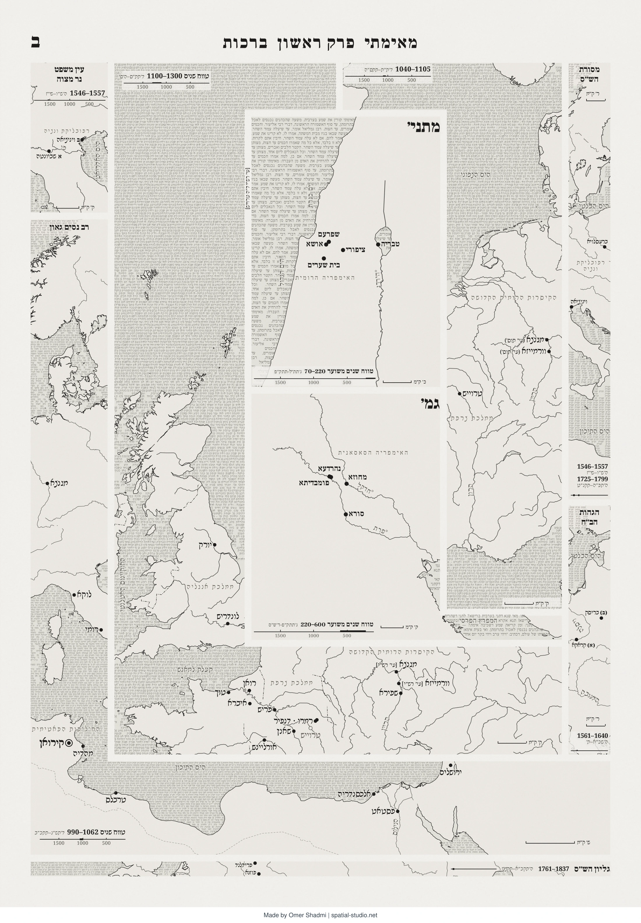
The map shows the spatial background of the different authors in the layout of the opening folio of the Vilna edition of the Babylonian Talmud (Berachot 2a). Each map replaces the original text and shows the corresponding authors’ historical spatial background. Each map keeps the shape and position of each commentary, uses the box’s own script for all of its lettering, and carries a timeline of the period in which the text was written. Through the map the Vilna folio becomes a journey into 1600 years of Jewish history and geography.
 View full map
 View full map
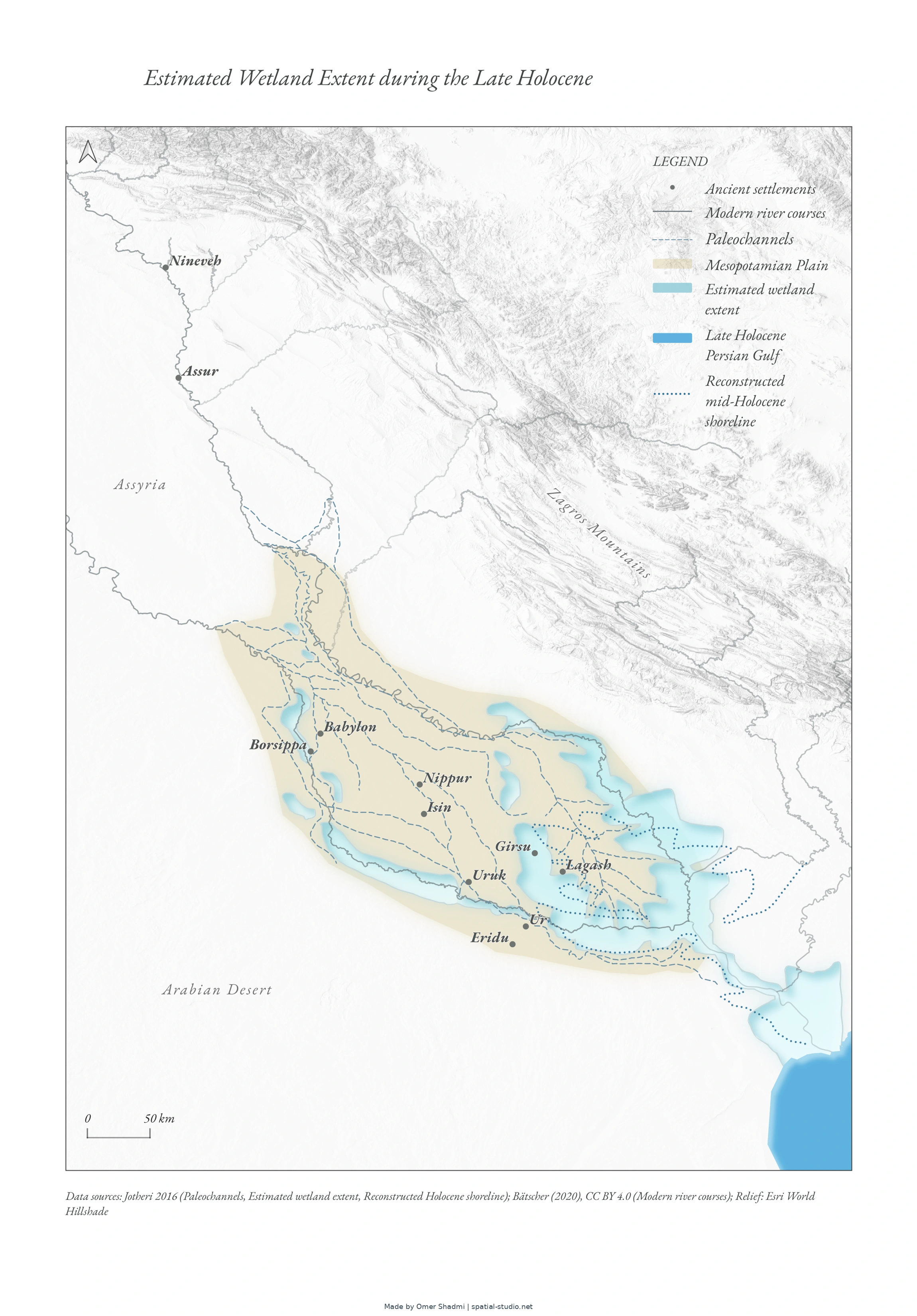
The map shows the estimate extent of wetlands in the Mesopotamian plain during the Late Holocene. For the dissertation “Lost in the Marshes: On the Ancient Mesopotamian Conception of Wetlands,” Hebrew University
 View full map
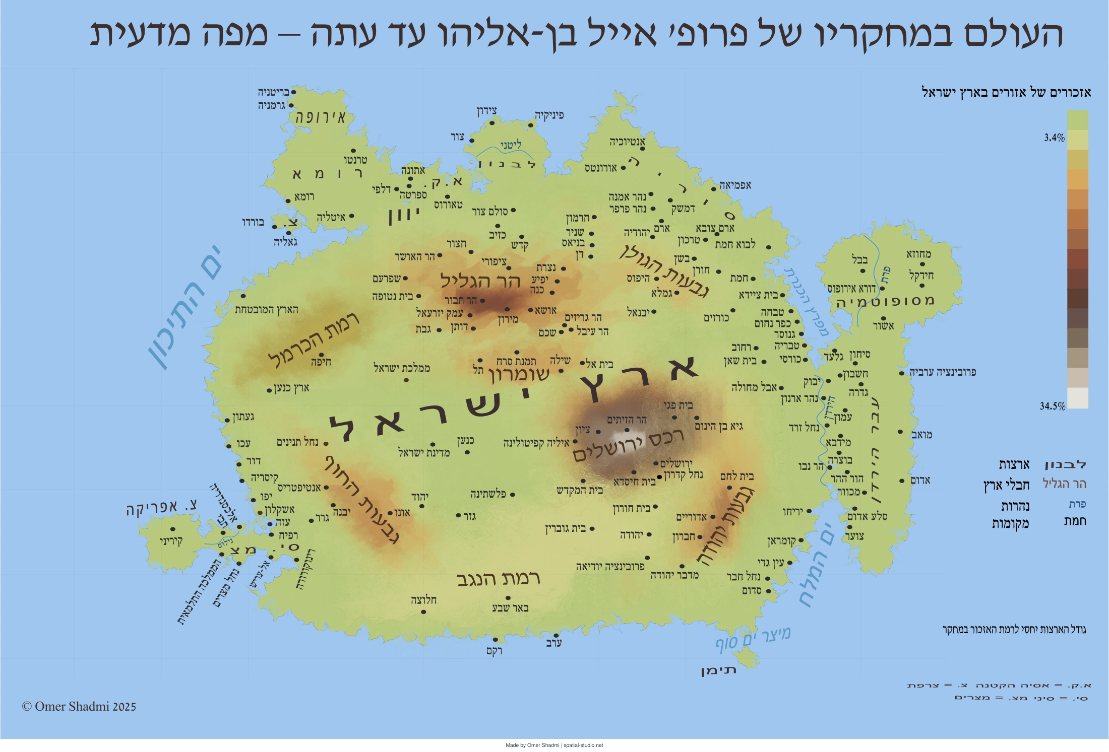
This map shows which parts of the world feature most prominently in Eyal Ben-Eliyahu’s published scholarship. Place names and geographical subjects were identified in his books and other publications, assigned numerical values, and grouped by region. The geographical shapes were then redrawn to make the resulting pattern visible. It is a map of research emphasis, not a conventional map of actual distances or land areas.
 View full map
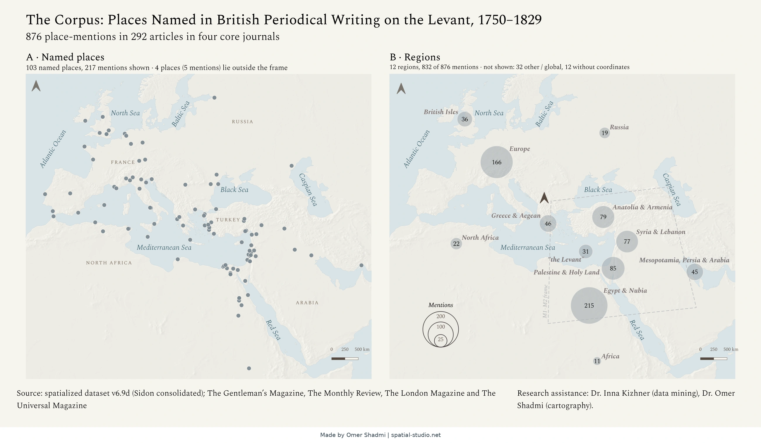
This map shows the places that British periodicals wrote about when they covered the Levant, the eastern shore of the Mediterranean, between 1750 and 1829. Panel A marks every named place with a dot. Panel B groups the mentions by region: the bigger the circle, the more often the region was mentioned. Together, the panels show where British writers looked.
 View full map
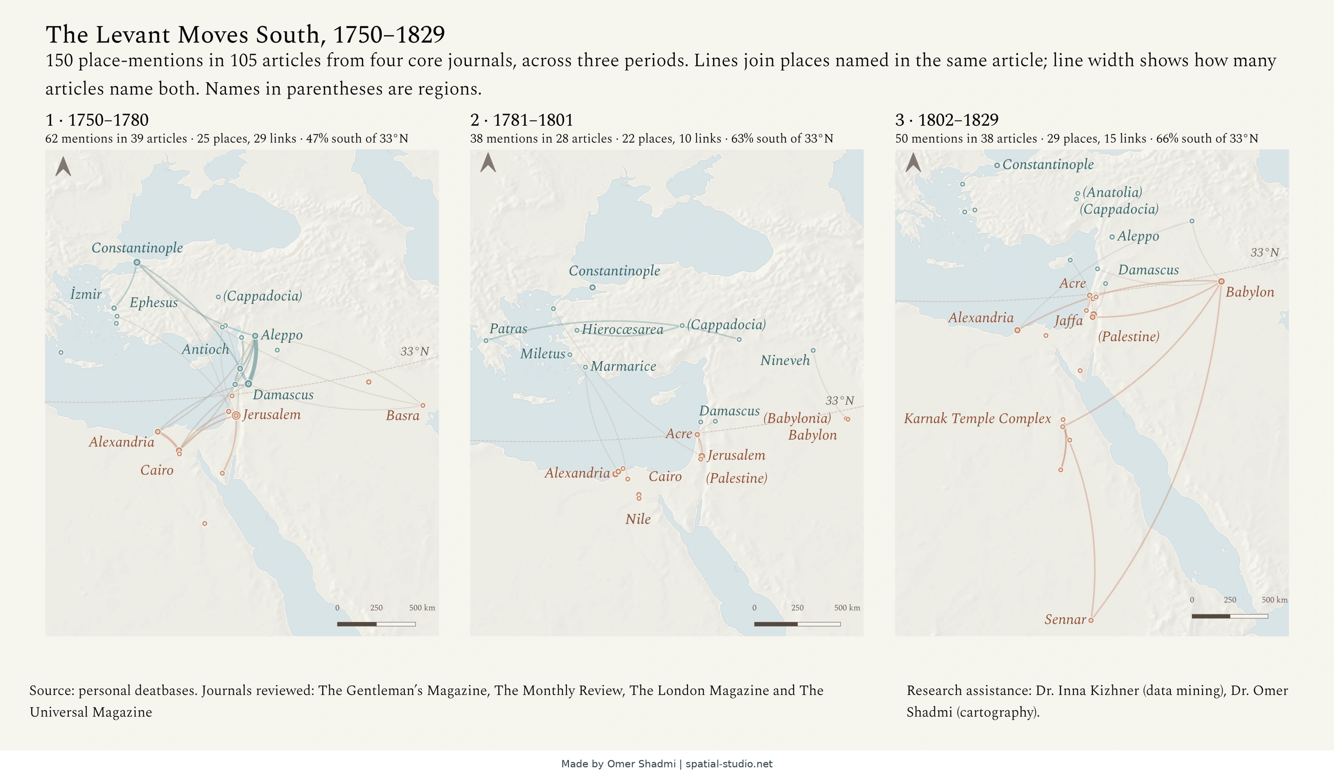
This map shows how the places British periodicals wrote about in the Levant changed between 1750 and 1829. It has three panels, one for each period. Rings mark the places named, and lines join places named in the same article. In each period, a larger share of the mentions falls south of 33°N.
 View full map
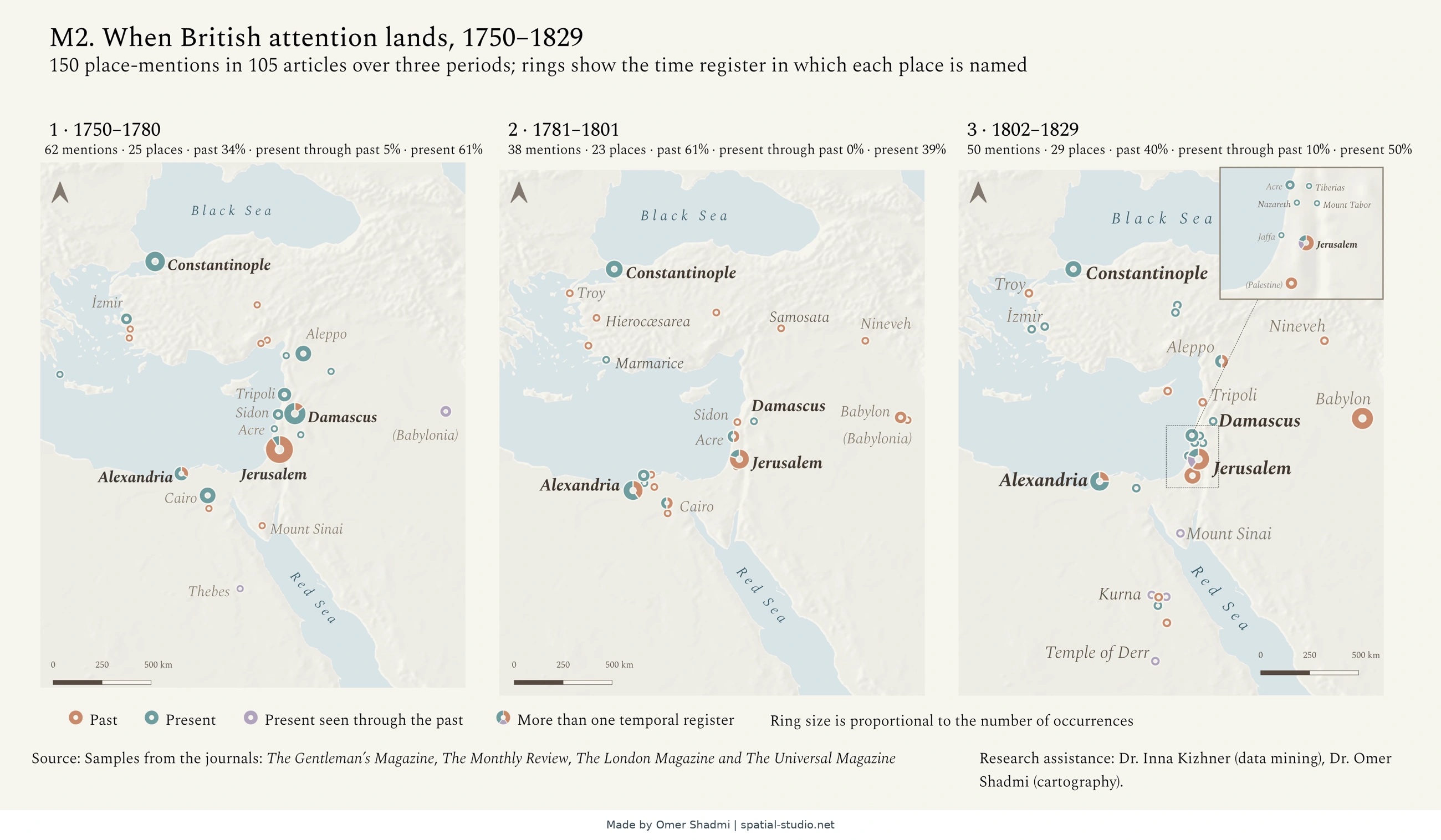
This map shows when British periodicals placed the Levant’s places in time. Each ring is a place, and its colour shows whether writers treated it as past, present, or the present seen through the past. A divided ring means a place was named in more than one way, and ring size shows how often it was mentioned. Three panels show three periods, 1750–1780, 1781–1801 and 1802–1829.
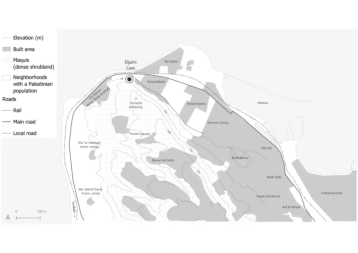
David Borabek, “Saint and the City: Elijah’s Cave in Haifa between Israelization and Resistance,” Journal of Urban History, forthcoming.