2 Lithology & Hydrography
50sqkm is an experimental digital atlas that explores the complexity of place through cartography. Each map presents a different aspect of the same place: a 50-square-kilometre area of particular geopolitical significance.
Every map is the result of careful research, combining information from multiple sources with an extended design process, aiming to create a geographical encyclopedia. Together, the maps tell the story of the area as an intersection of natural, social, historical, and political conditions. Visitors are invited to explore the atlas, consider the relationships it reveals, and respond.
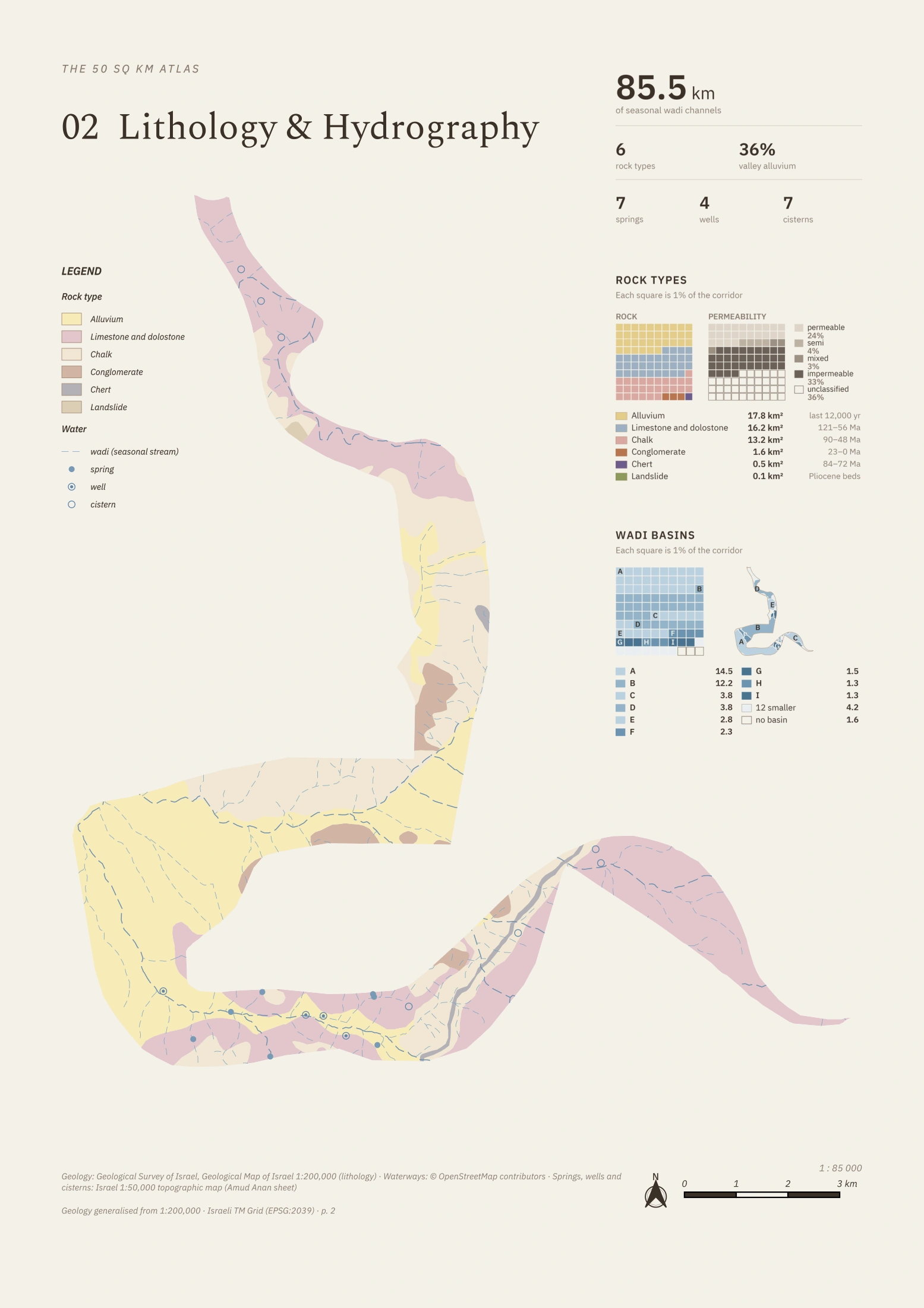 Enlarge map
Methodology documentation forthcomingFound an error in this map? Let me know.